
NASA's Top 10 Views of Earth
mzeBONE
Published
12/17/2008
Beats the hell out of google earth
- List View
- Player View
- Grid View
Advertisement

-
1.
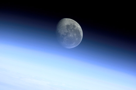 The moon appears through a halo, called the limb, that covers the Earth, as seen in 2001.
 -
2.
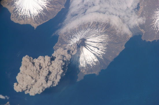 An eruption of Cleveland Volcano in the Aleutian Islands, Alaska, which lasted only hours.
 -
3.
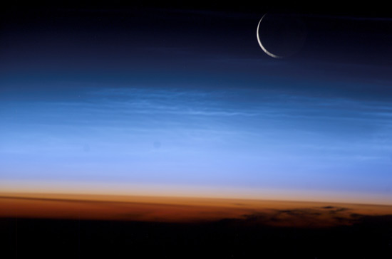 In this 2003 photo from Expedition 7, you can see layers of the Earth's atmosphere. The orange troposhere is the lowest and most dense section. The tropopause is the section between the troposphere and the blue atmosphere.
 -
4.
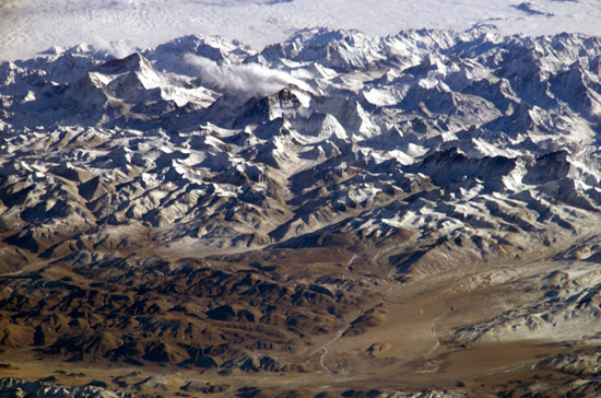 The height of Mount Everest and the Himalayas makes this 2004 photo look as if it came from an airplane
 -
5.
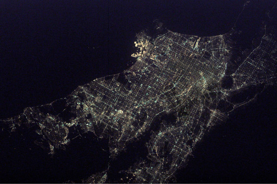 This Los Angeles-at-night photo was taken in 2003. Hollywood is at the bottom, and the bright lights in the north are from the port facilities at Long Beach Naval Shipyards and Los Angeles International Airport. The brightest lights near the center are from Disneyland, of course.
 -
6.
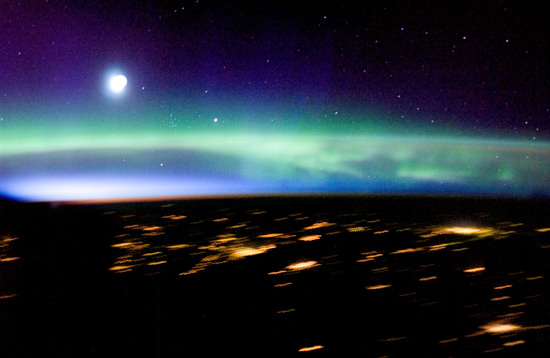 Aurora Borealis and lights shine over Finland, Russia, Estonia, and Latvia in 2005.
 -
7.
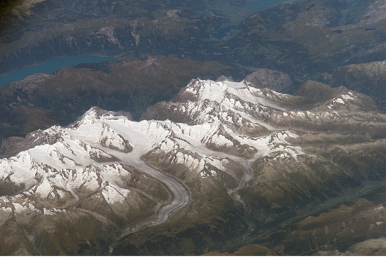 Notice the glaciers flowing from the Bernese Alps of Switzerland in this 2006 photo.
 -
8.
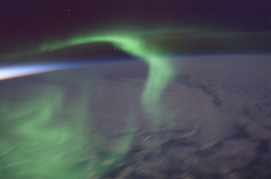 This green aurora showed up just after sunset in 2003.
 -
9.
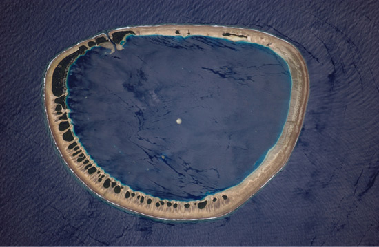 Nukuoro Atoll is one of 607 islands that make up the Federated States of Micronesia, as shown in this 2006 photo. About 900 people live on this atoll, whose lagoon is less than 4 miles wide.
 -
10.
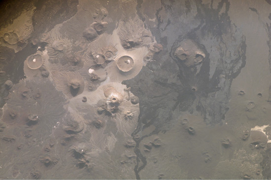 This volcanic region of Saudi Arabia is known as Harrat Khaybar, as seen in a 2008 photo. Volcanoes flowed in the north-south vent system over the past 5 million years, though the most recent eruption was between 600 A.D. and 700 A.D.

- REPLAY GALLERY
-
- NASA's Top 10 Views of Earth
- NEXT GALLERY
-

- 42 Fascinating Fun Photos to Rule The Week
The moon appears through a halo, called the limb, that covers the Earth, as seen in 2001.
10/10
1/10


4 Comments