That's certainly a different way of looking at it.
These maps present America in a new light, in ways you never thought of looking at it before. They're full of
interesting data!
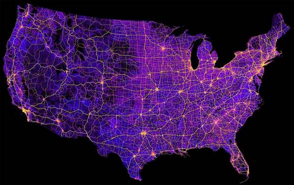
1
8 Million Miles Of Highways And Roads
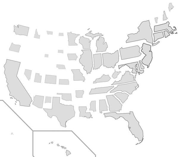
2
States Resized According To Population Density
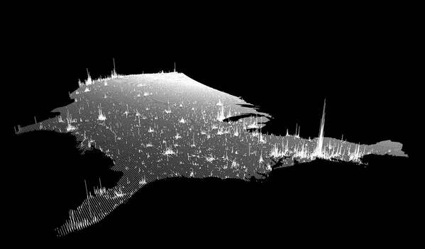
4
Population Spikes From A New Angle
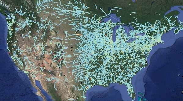
5
The Most Efficient Road Trip Through Every Springfield In The Country
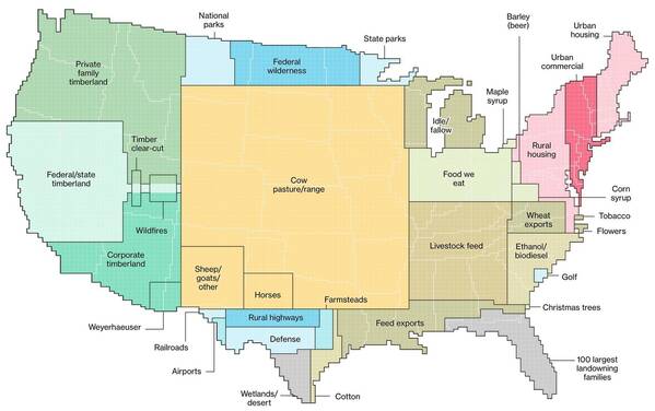
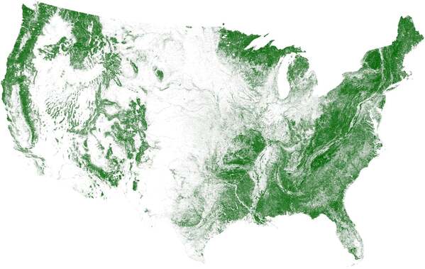
6
How We Use Land In The United States. 0% Is Zipline Territory And That’s Some BS
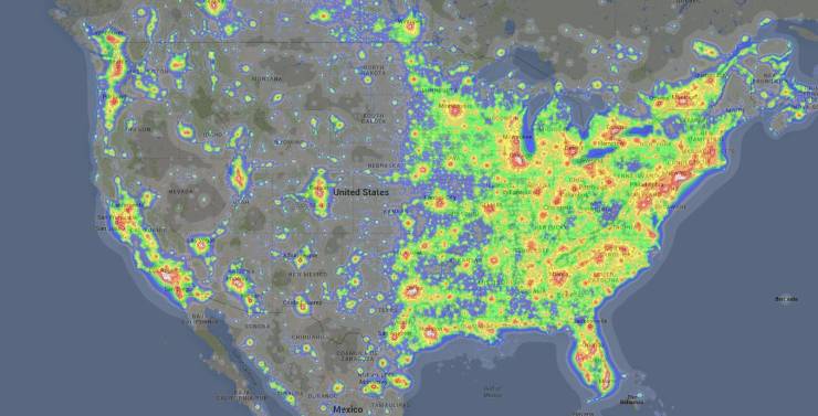
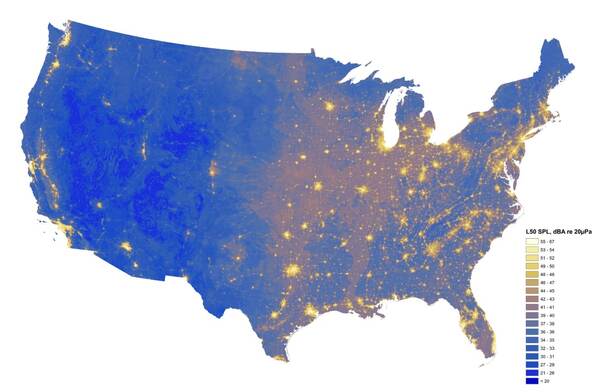
7
Light Pollution From Coast To Coast
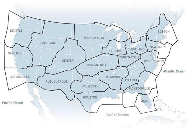
8
Broken Up By Air Traffic Control Zones
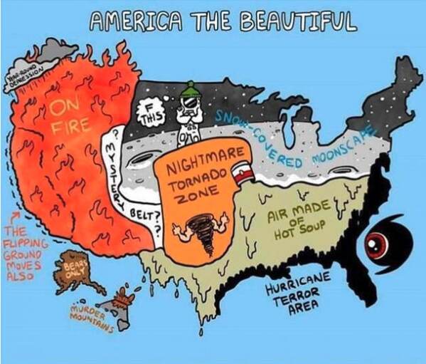
9
Dominant Regional Weather Types
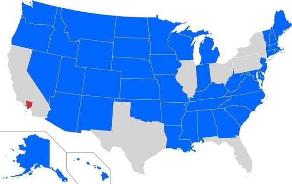
10
Blue States Have A Smaller Population Than Los Angeles County
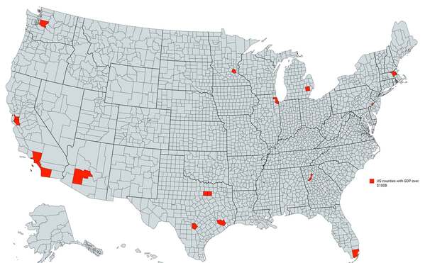
11
Counties With A GDP Over $100 Billion
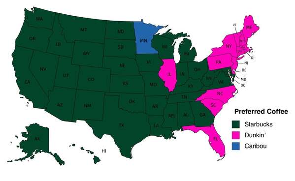
12
Popular Coffee Shop Chains By Number Of Locations
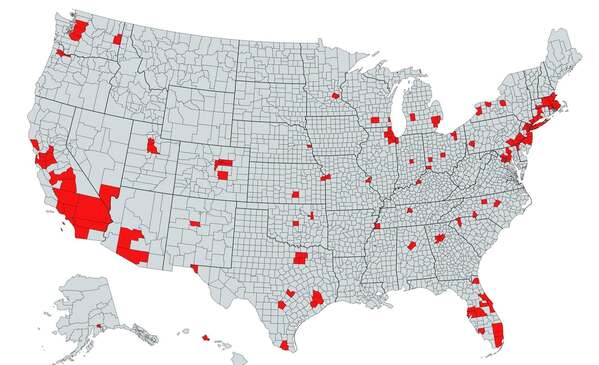
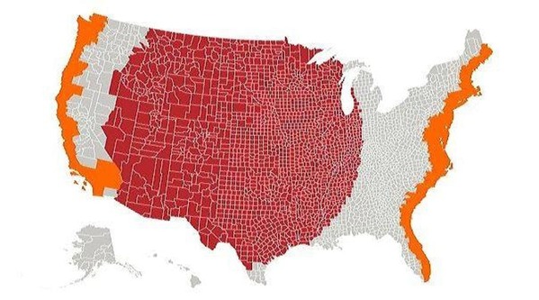
13
The Red Area Features A Total Population Greater Than The Grey
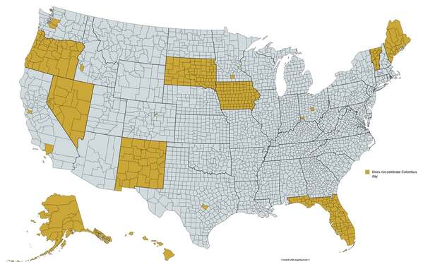
14
Regions That Do Not Officially Celebrate Columbus Day
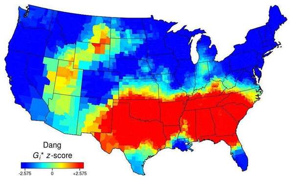
15
Use Of The Word “Dang” Across The Continental US
16
The Red And Orange Sections Have Equal Populations
18
The Loudest And Quietest Spots In The Continental US