
18 Captivating Maps of Our World
zachnading
Published
11/24/2022
in
wow
Thanks to Amazing Maps on Twitter, we've collected some of the most interesting and informative maps we could find. Enjoy!
- List View
- Player View
- Grid View
Advertisement

-
1.
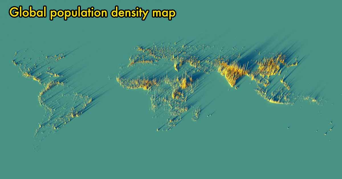 The world is full of all kinds of fascinating facts and information. However, sometimes just looking at numbers on a page can be hard to understand and may not give you a clear understanding of the data. Thanks to Amazing Maps on Twitter, we've collected some of the most interesting and informative maps we could find. Enjoy!
 -
2.
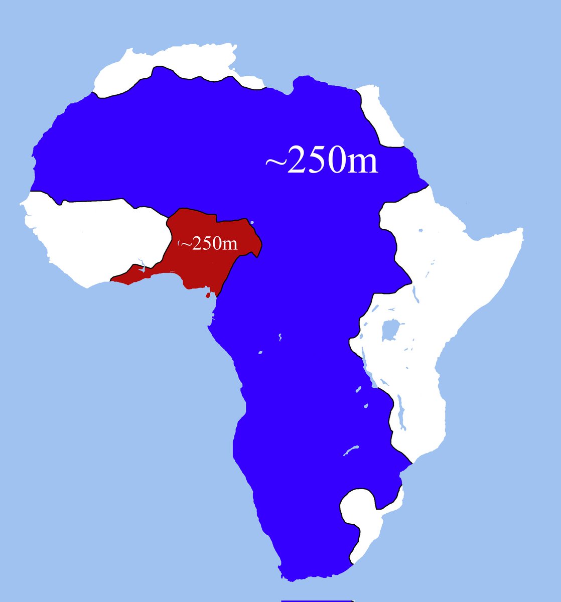 The red and blue areas have about the same population in Africa.
 -
3.
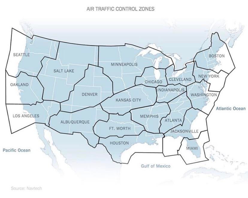 Air traffic control zones in the United States.
 -
4.
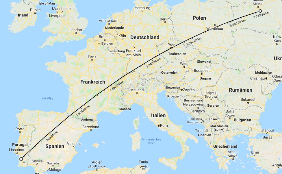 The US/Mexico border if it were stretched over Europe.
 -
5.
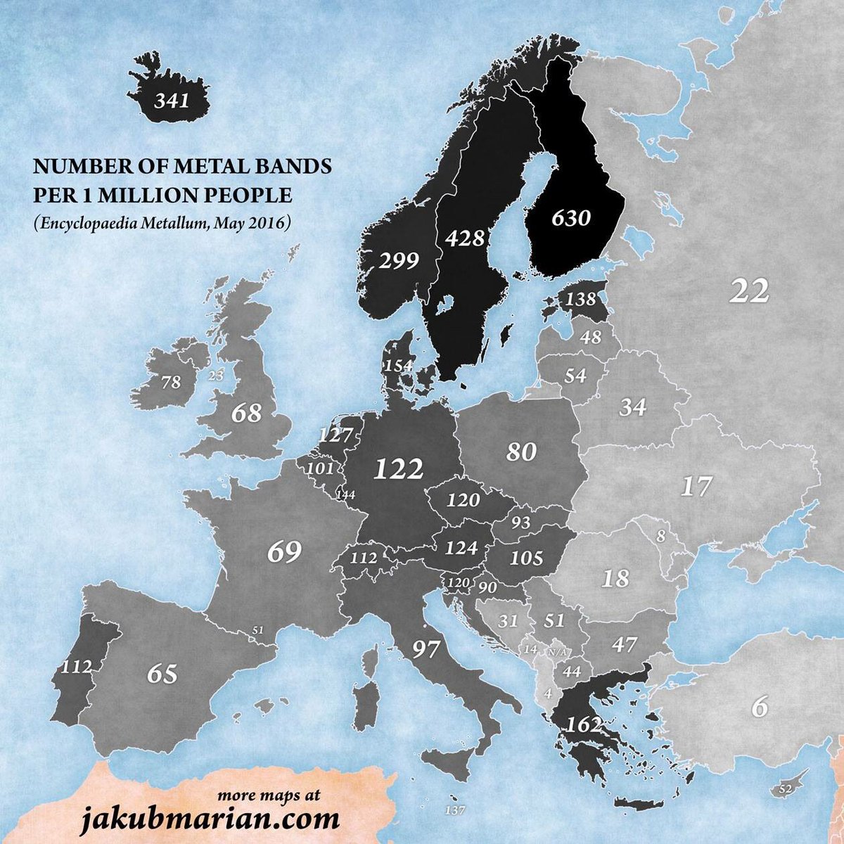 This one is very important. Heavy metal bands per 1 million people.
 -
6.
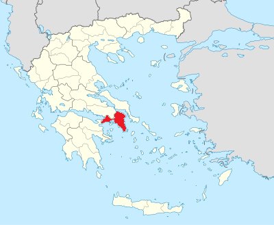 40 percent of Greece's total population lives in the red areas.
 -
7.
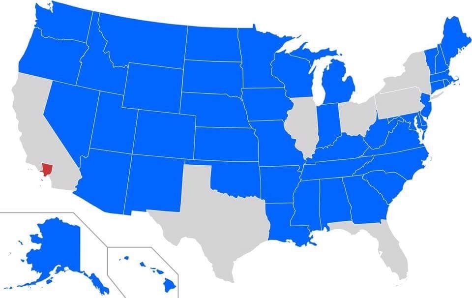 All of the blue areas still have a smaller population than Los Angeles County (red.)
 -
8.
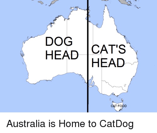 CatDog wasn't just a cartoon on Nickelodeon.
 -
9.
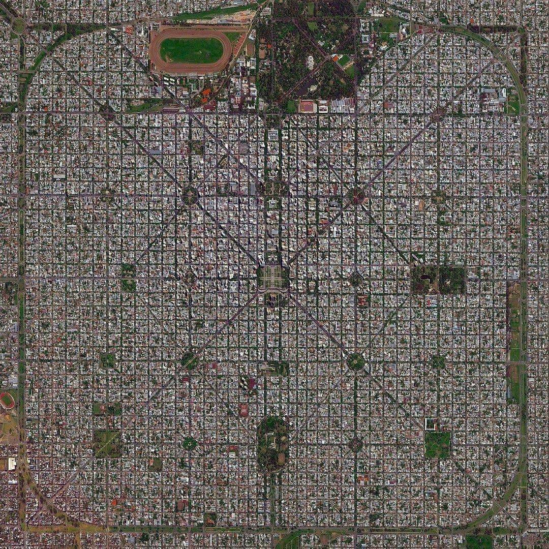 An incredible aerial view of La Plata, Argentina.
 -
10.
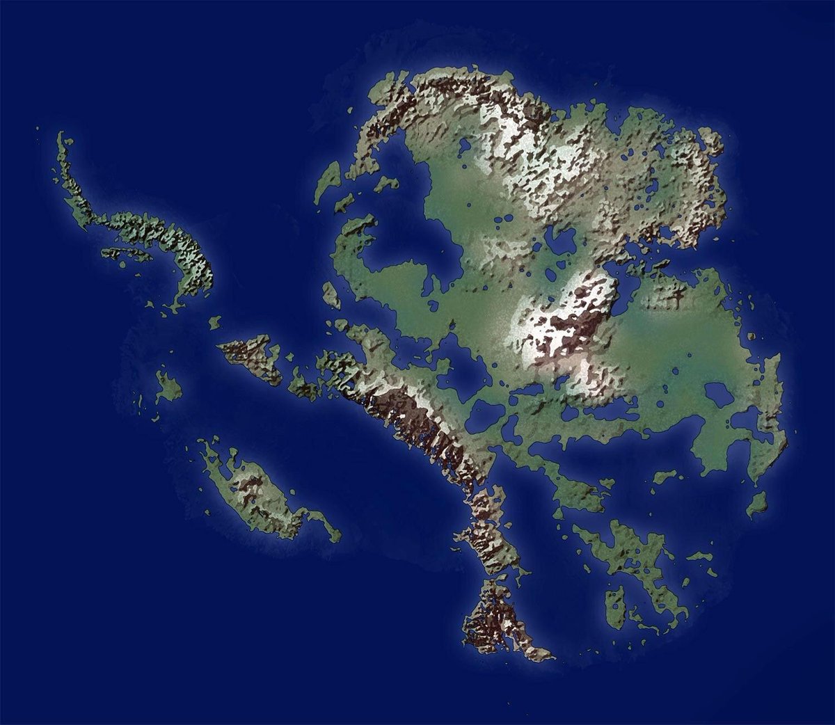 What if Antarctica had no ice whatsoever?
 -
11.
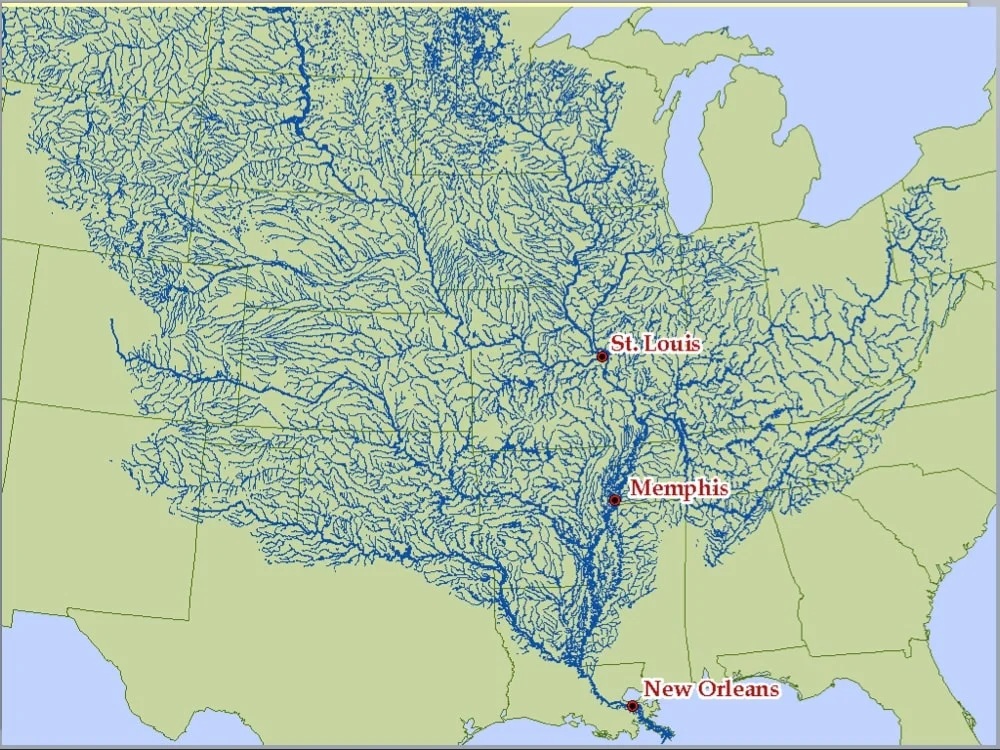 The Mississippi River and all of its tributaries.
 -
12.
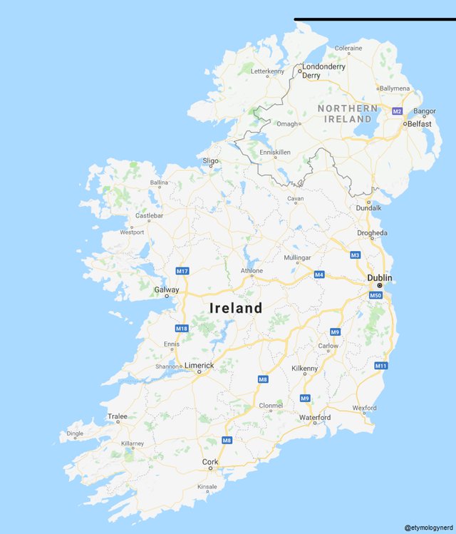 Ireland's northern most point is still more northern than Northern Ireland.
 -
13.
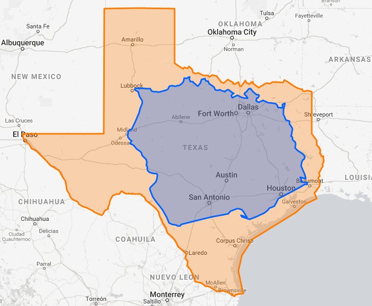 Poland could fit inside of Texas, with room to spare.
 -
14.
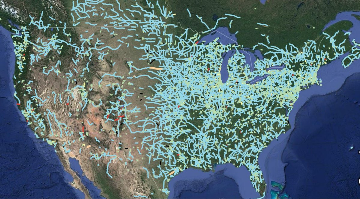 Out of service and/or abandoned railway lines.
 -
15.
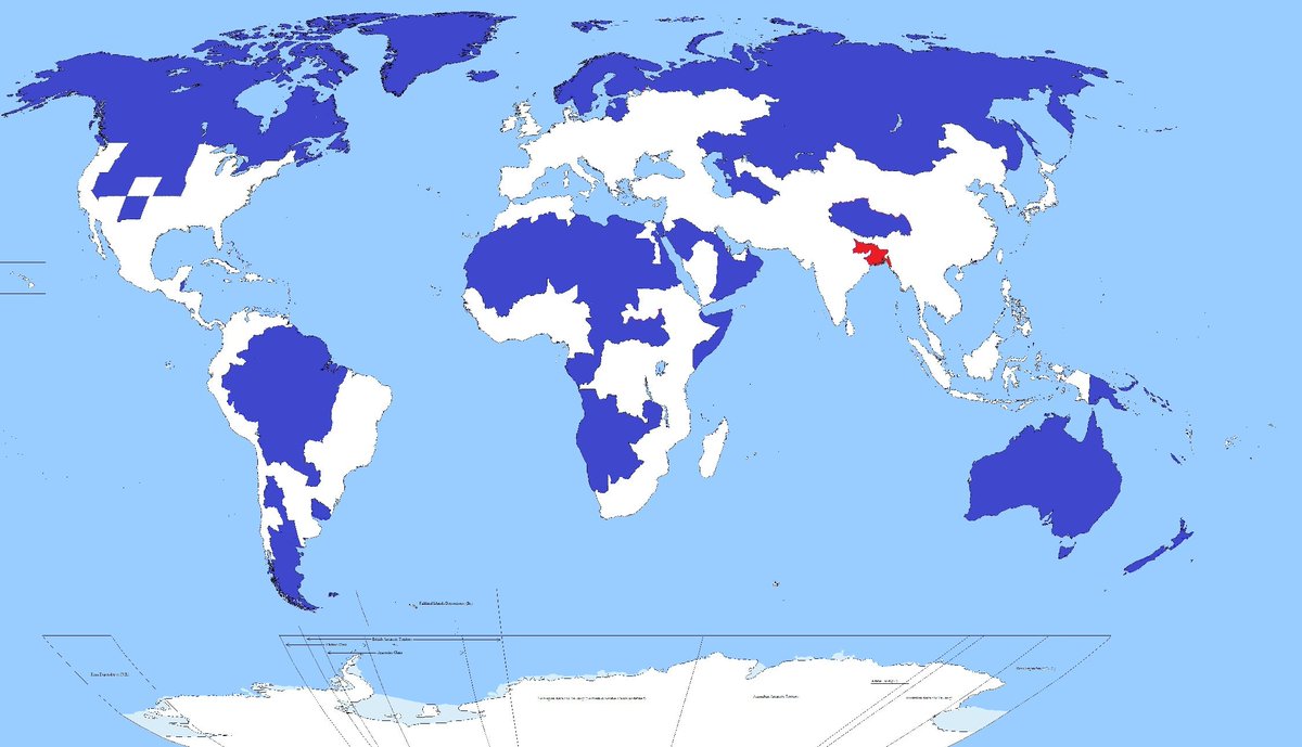 5% of the world's population lives in the red area. While another 5% live in the blue.
 -
16.
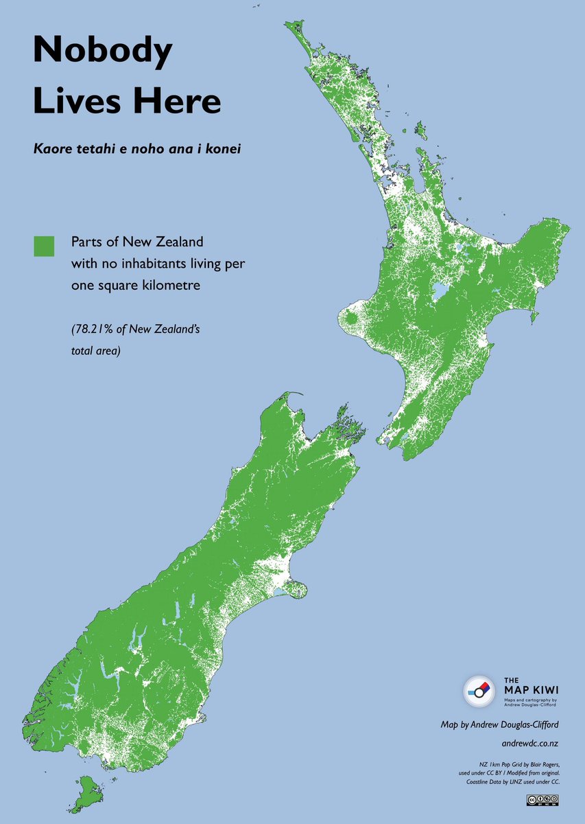 Parts of New Zealand with no people.
 -
17.
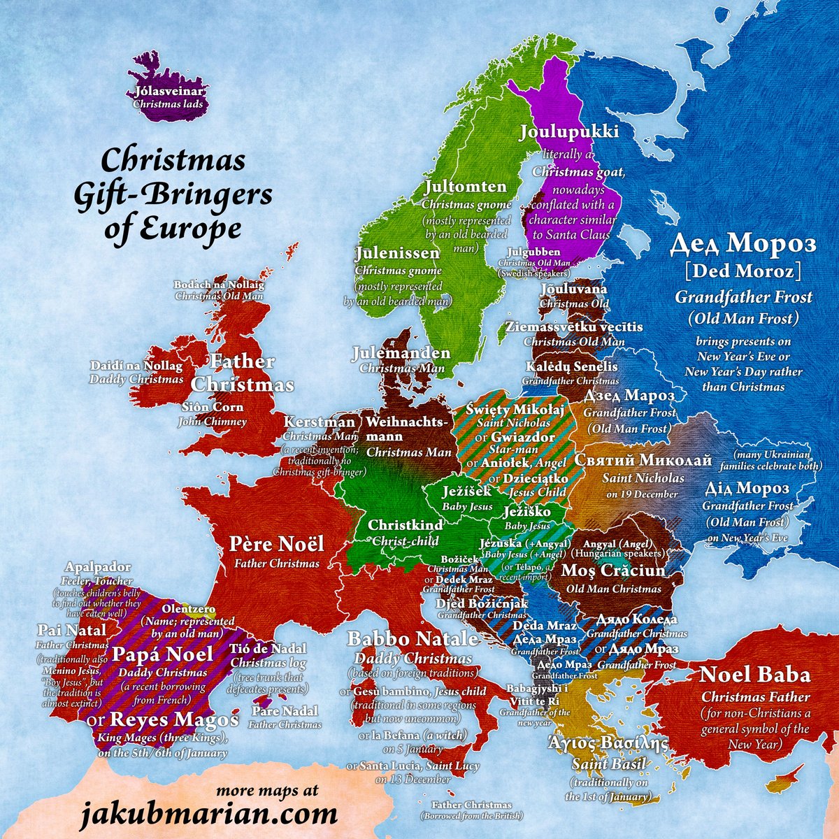 "Santa" all around the world.
 -
18.
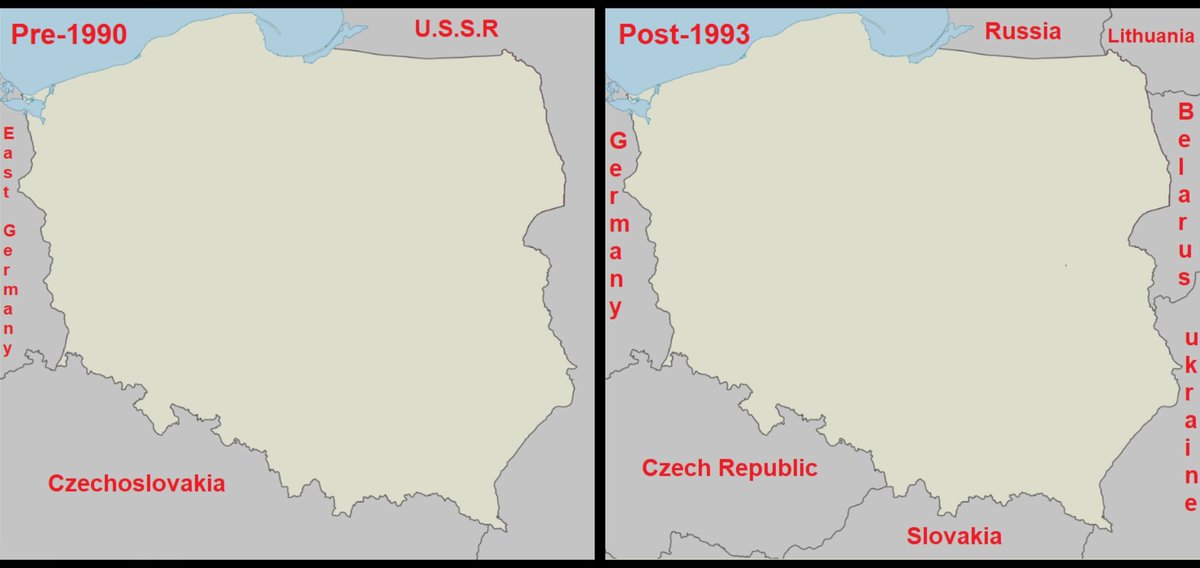 None of Poland's border countries before 1990 exist today.
 -
19.
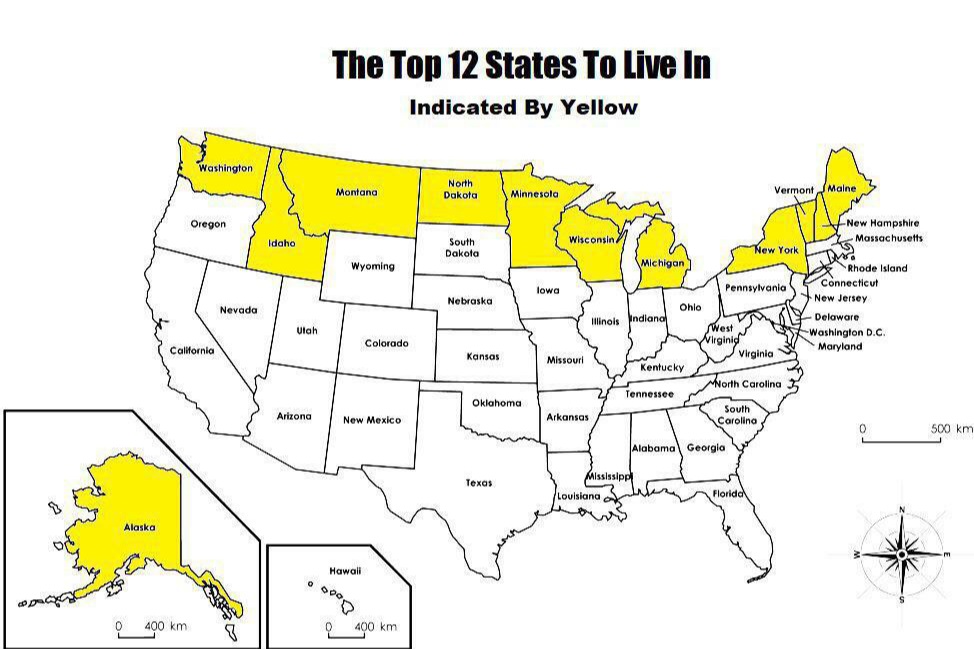 The Top 12 states to Live in. Literally.
- REPLAY GALLERY
-

- 18 Captivating Maps of Our World
- NEXT GALLERY
-

- Funny Memes and Pics to Chuckle With (22 Images)

The world is full of all kinds of fascinating facts and information. However, sometimes just looking at numbers on a page can be hard to understand and may not give you a clear understanding of the data. Thanks to Amazing Maps on Twitter, we've collected some of the most interesting and informative maps we could find. Enjoy!
19/19
1/19


3 Comments