
18 Maps With Interesting Data About America
That's certainly a different way of looking at it.
These maps present America in a new light, in ways you never thought of looking at it before. They're full of interesting data!
These maps present America in a new light, in ways you never thought of looking at it before. They're full of interesting data!
- List View
- Player View
- Grid View
Advertisement

-
1.
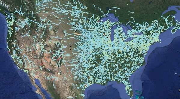
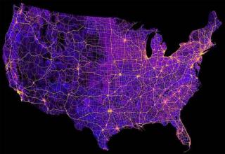
 8 Million Miles Of Highways And Roads
 -
2.
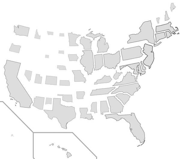 States Resized According To Population Density
 -
3.
 Out Of Service Railways
 -
4.
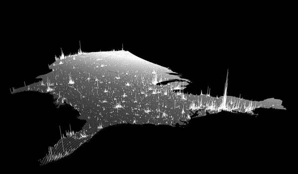 Population Spikes From A New Angle
 -
5.
 The Most Efficient Road Trip Through Every Springfield In The Country
 -
6.
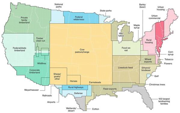 How We Use Land In The United States. 0% Is Zipline Territory And That’s Some BS
 -
7.
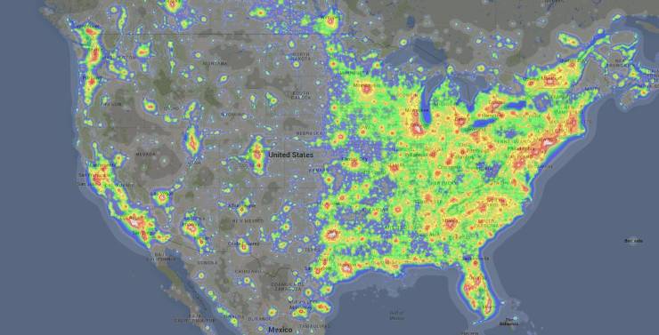 Light Pollution From Coast To Coast
 -
Advertisement
-
8.
 Broken Up By Air Traffic Control Zones
 -
9.
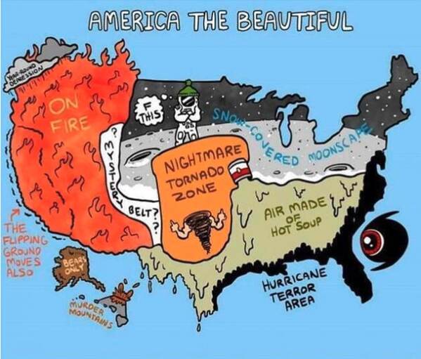 Dominant Regional Weather Types
 -
10.
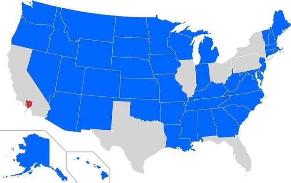 Blue States Have A Smaller Population Than Los Angeles County
 -
11.
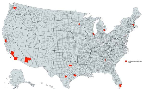 Counties With A GDP Over $100 Billion
 -
12.
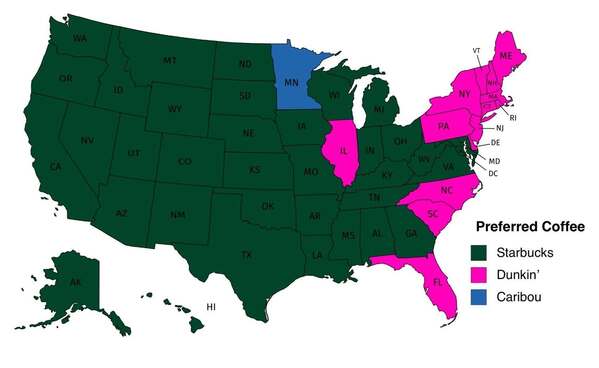 Popular Coffee Shop Chains By Number Of Locations
 -
13.
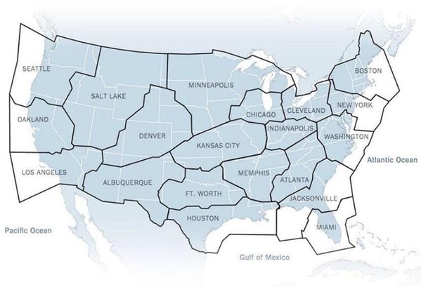
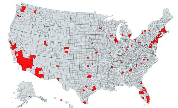 The Red Area Features A Total Population Greater Than The Grey
 -
14.
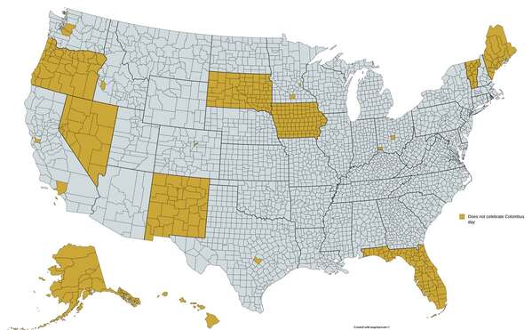 Regions That Do Not Officially Celebrate Columbus Day
 -
15.
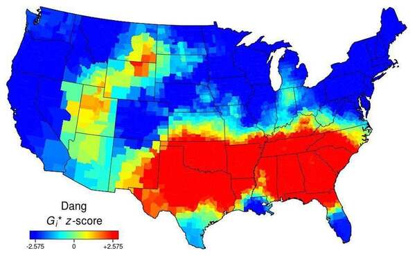 Use Of The Word “Dang” Across The Continental US
 -
16.
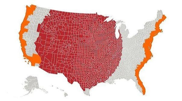 The Red And Orange Sections Have Equal Populations
 -
17.
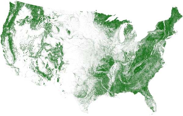 Tree Cover, Visualized
 -
18.
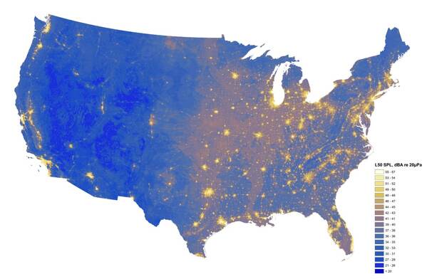 The Loudest And Quietest Spots In The Continental US
- REPLAY GALLERY
-

- 18 Maps With Interesting Data About America


8 Million Miles Of Highways And Roads
18/18
1/18
Categories:
Wow


3 Comments