
Mapping Some Sense Into The World
Mr_Incognito
Published
08/16/2013
in
People & Lifestyle
A collection of interesting facts illustrated with maps.
- List View
- Player View
- Grid View
Advertisement

-
1.
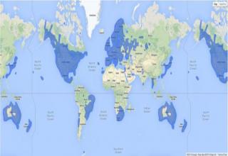
 Where Google Street View is Available
 -
2.
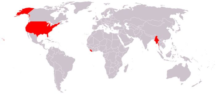 Countries That Do Not Use the Metric System
 -
3.
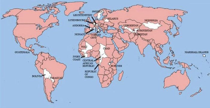 The Only 22 Countries in the World Britain Has Not Invaded
 -
4.
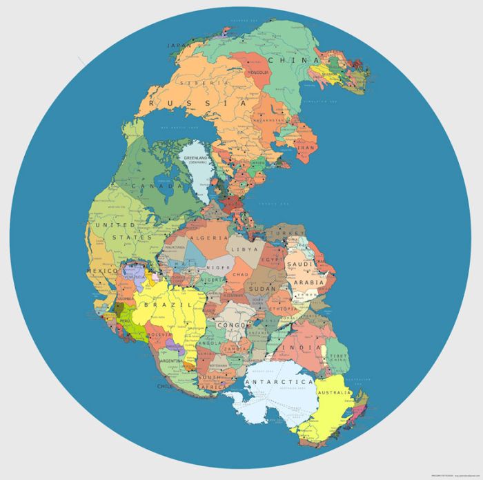 Map of Pangea with Current International Borders
 -
5.
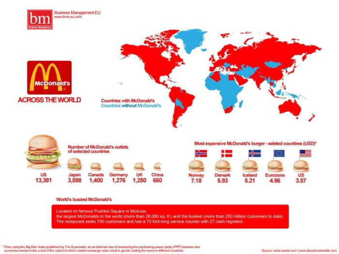 McDonalds Across the World
 -
6.
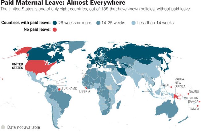 Paid Maternal Leave Around the World
 -
7.
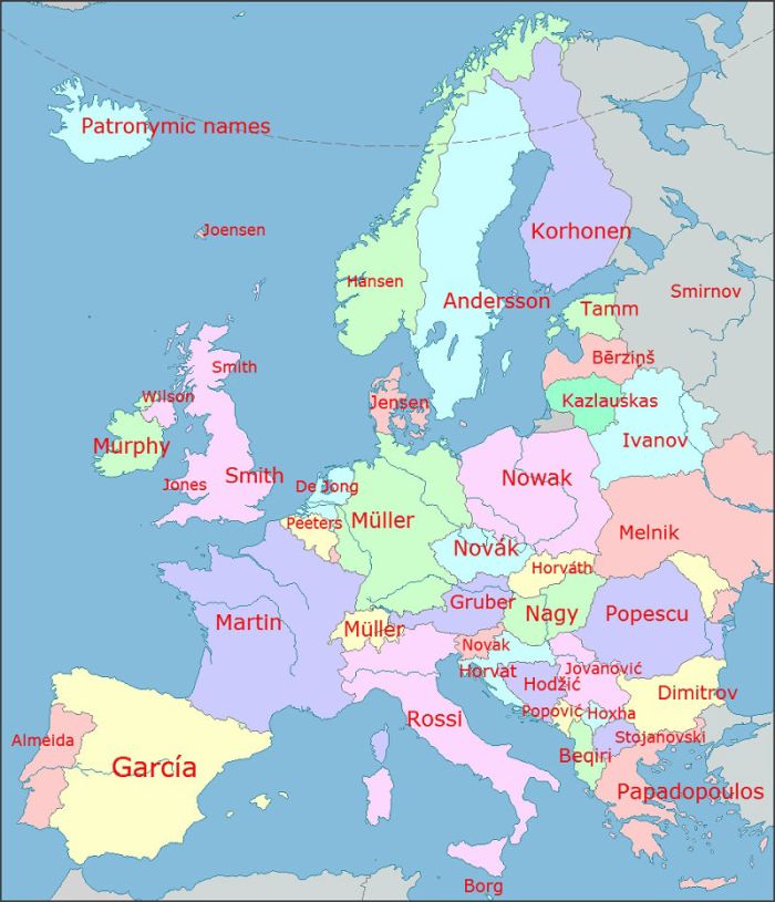 The Most Common Surnames in Europe by Country
 -
8.
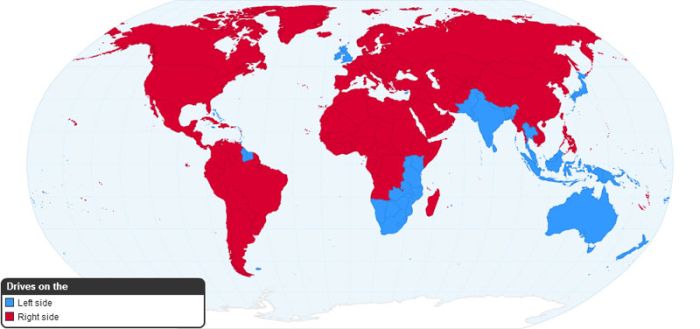 Worldwide Driving Orientation by Country
 -
9.
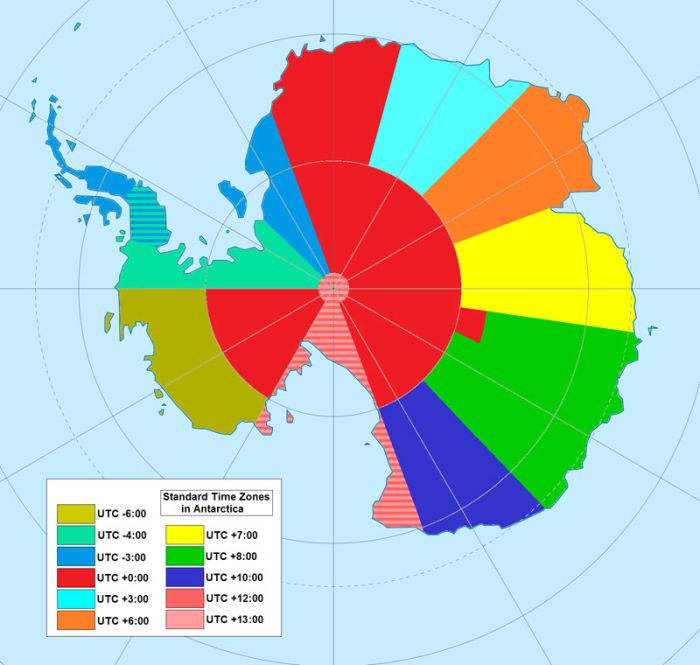 Map of Time Zones in Antarctica
 -
10.
 Global Internet Usage Based on Time of Day
 -
11.
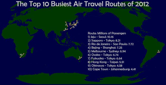 The Worlds Busiest Air Routes in 2012
 -
12.
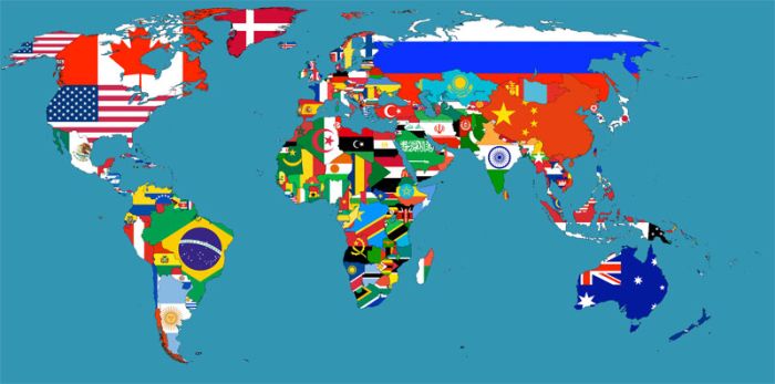 Flag Map of the World
 -
13.
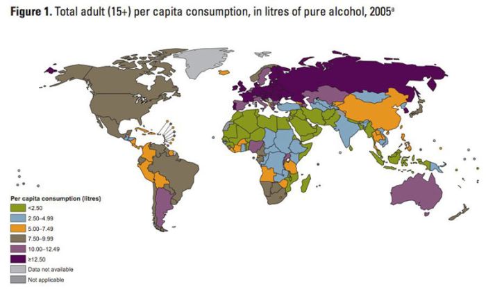 Map of Alcohol Consumption Around the World
 -
14.
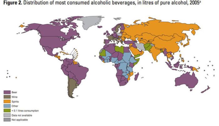 Map of Alcoholic Drink Popularity by Country
 -
15.
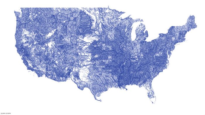 Map of Rivers in the Contiguous United States
 -
16.
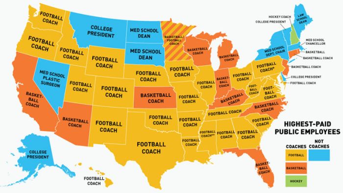 US Map of the Highest Paid Public Employees by State
 -
17.
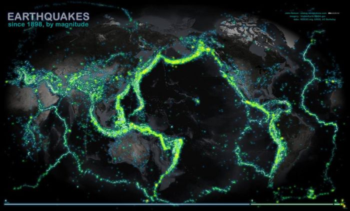 World Map of Earthquakes Since 1898
 -
18.
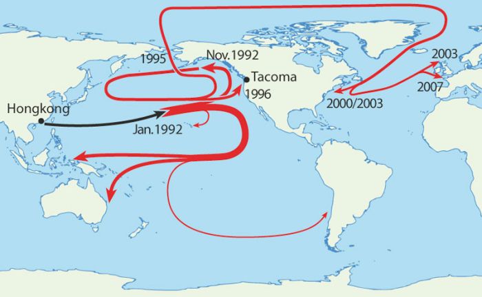 Map of Where 29,000 Rubber Duckies Made Landfall After Falling off a Cargo Ship in the Middle of the Pacific Ocean
 -
19.
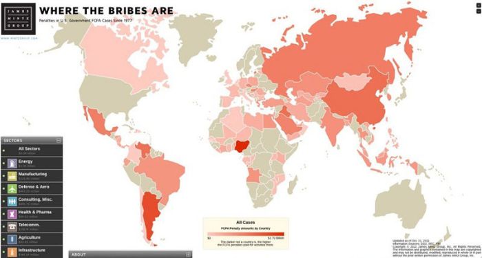 Map of Countries with the Most Violations of Bribery
 -
20.
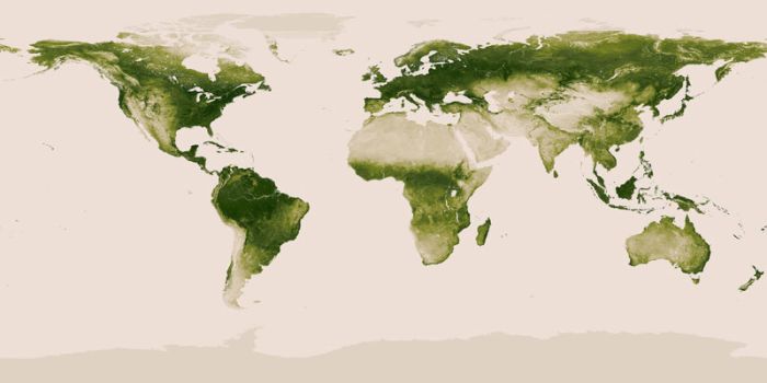 World Map of Vegetation on Earth
 -
21.
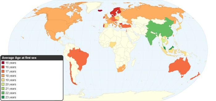 Average Age of First Sexual Intercourse by Country
 -
22.
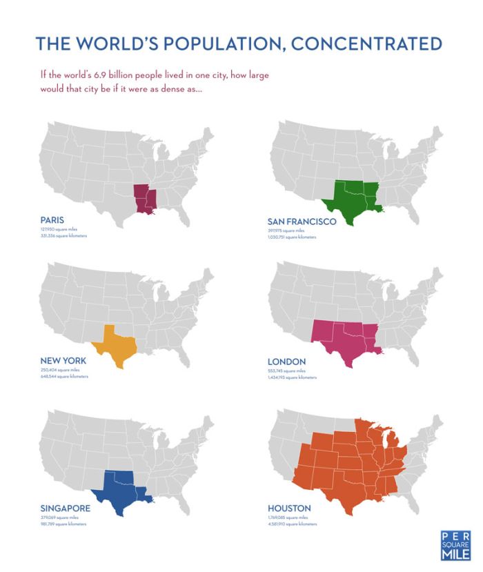 If the Worlds Population Lived in One City
 -
23.
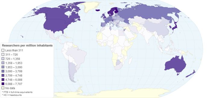 The Number of Researchers per Million Inhabitants
 -
24.
 Worldwide Map of Oil Import And Export Flows
 -
25.
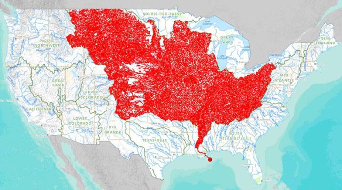 The 7000 Rivers that Feed into the Mississippi River
 -
26.
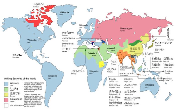 World Map of the Different Writing Systems
 -
27.
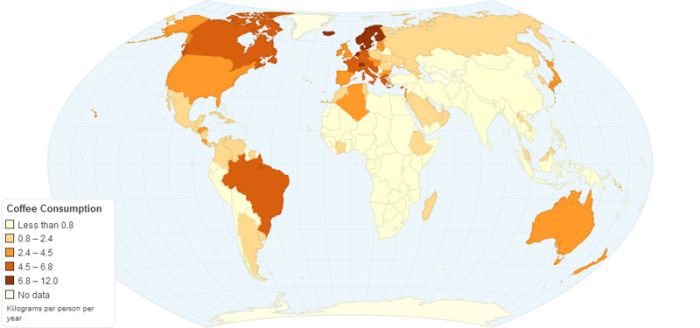 Worldwide Annual Coffee Consumption Per Capita
 -
28.
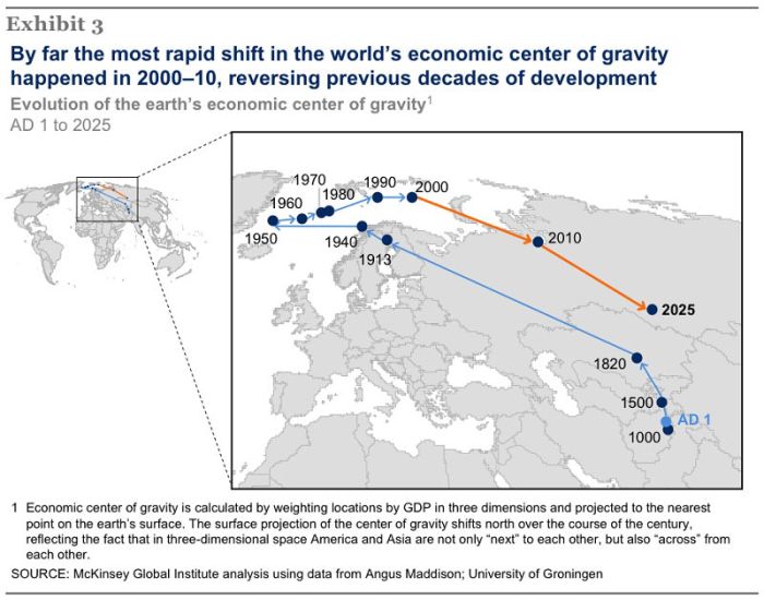 The Economic Center of Gravity Since 1 AD
 -
29.
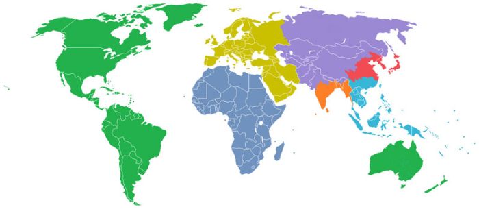 The World Divided Into 7 Regions, each with a Population of 1 Billion
 -
30.
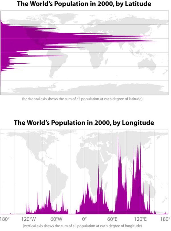 Earths Population by Latitude and Longitude
 -
31.
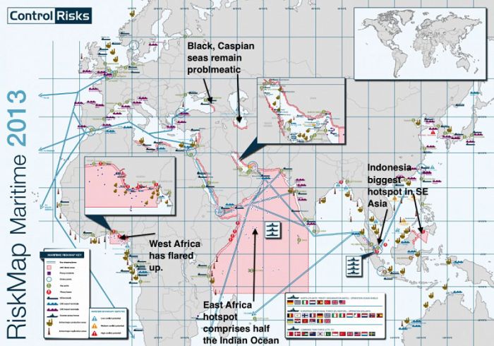 The Most Dangerous Areas in the World to Ship Due to Pirates
 -
32.
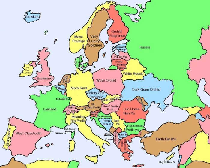 Map of Europe Showing Literal Chinese Translations for Country Names
 -
33.
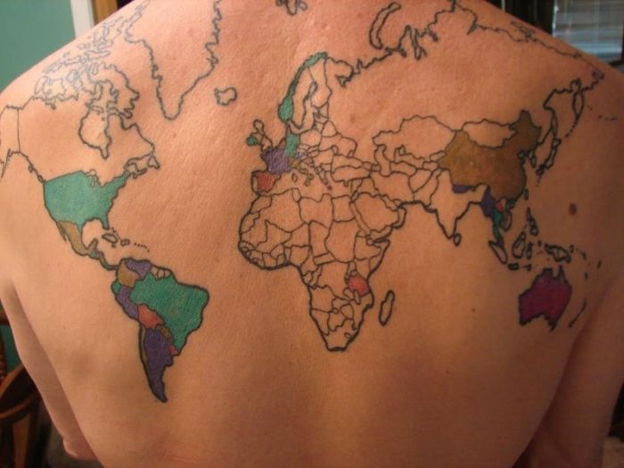 World Map Tattoo with Countries Visited Coloured
- REPLAY GALLERY
-

- Mapping Some Sense Into The World
- NEXT GALLERY
-

- I Don't Want to Live on This Planet Anymore

Where Google Street View is Available
33/33
1/33
Categories:
People & Lifestyle


82 Comments